


NASA launches international mission to survey Earth's water
- In Reports
- 02:28 PM, Dec 17, 2022
- Myind Staff
NASA has launched the first-ever global satellite mission that will observe nearly all water on Earth's surface, measuring the height of water in the planet’s lakes, rivers, reservoirs, and oceans.
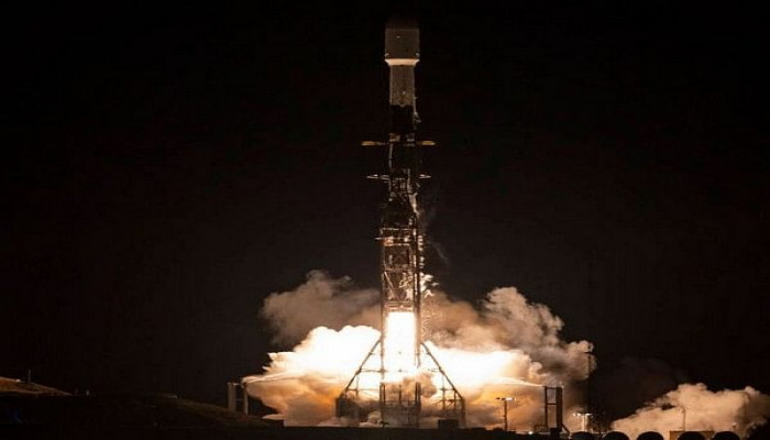
The Surface Water and Ocean Topography (SWOT) spacecraft atop a SpaceX Falcon 9 rocket was launched from Vandenberg Space Force Base in California on Friday.
"Warming seas, extreme weather, more severe wildfires -- these are only some of the consequences humanity is facing due to climate change," said NASA Administrator Bill Nelson.
"The climate crisis requires an all-hands-on-deck approach, and SWOT is the realisation of a long-standing international partnership that will ultimately better equip communities so that they can face these challenges," Nelson added.
According to NASA, SWOT will cover the entire Earth’s surface between 78 degrees south and 78 degrees north latitude at least once every 21 days, sending back about one terabyte of unprocessed data per day.
“The scientific heart of the spacecraft is an innovative instrument called the Ka-band radar interferometer (KaRIn), which marks a major technological advance. KaRIn bounces radar pulses off the water’s surface and receives the return signal using two antennas on either side of the spacecraft,” the space agency added.
Karen St. Germain, NASA Earth Science Division director, they are eager to see SWOT in action. “This satellite embodies how we are improving life on Earth through science and technological innovations. The data that innovation will provide is essential to better understanding how Earth’s air, water, and ecosystems interact – and how people can thrive on our changing planet.”
“This mission marks the continuity of 30 years of collaboration between NASA and CNES in altimetry,” said Caroline Laurent, CNES Orbital Systems and Applications director.
“It shows how international collaboration can be achieved through a breakthrough mission that will help us better understand climate change and its effects around the world," Laurent added.
According to NASA, SWOT measurements will also help researchers, policymakers, and resource managers better assess and plan for things, including floods and droughts. By providing information on where the water is – where it’s coming from and where it’s going – researchers can improve flood projections for rivers and monitor drought effects on lakes and reservoirs.
Image courtesy: NASA website


Comments